Walking 1000 miles from Lands end to John O'Groats in aid of The Air Ambulance (starts april 7th 2024)

Tuesday, 18 June 2013

Day 2 17/6/2013– Evacuation!

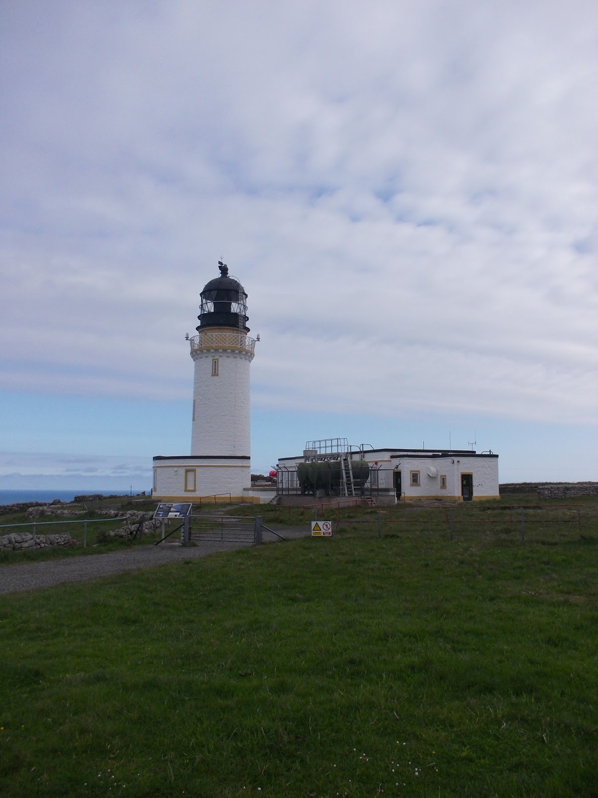
Cape Wrath Light house
Waking to a clearing sky we get the nasty surprise of being told that everyone is being evacuated from Kearvaig as an Raf bombing practice is going to take place within the hour, no more than half a mile from the bothie!
Quickly packed this works to our advantage as the evacuation sees us getting a free lift to Cape wrath light house taking a chunk out of the route! Even better there's a cafe at the light house so tea and sandwiches are consumed as we watch a Typhoon circle kearvaig stack a small granite island the Raf have been bombing since 1927, tho this has allegedly caused no damage in all this time! Disappearing above the clouds the the Typhoon repeatedly hits the island with small and largely unimpressive bombs..... Could explain why the island still exists!

Distant explosion on An Garbh-eilean


With the bombing over and full belies (cunning easy to trap the tourist pound!) we leave the farthest north West point and head south along the wild and deeply undulating coastline in quickly improving weather, past a small group of dear we leave the track and start off across the unusually dry boggy landscape passing many cluster of insectivorous sundew plants (more obviously needed for midge control!), occasionally dodging inland or down and up we pass a variety of gulleys,  as lunch time arrives and with the sun now a regular thing we find a suntrap by steam to make tea and fill up on food.

As we progress south the cliff's become more broken and at one point look remarkably like abandoned building works! Or the building blocks of the gods ;-)
Heading steeply down to the bay of Keisgaig we sit to catch our breath and get the treat of watching two sea Otters playing and bathing by rocks in the bay, and briefly a seal showed it's head and then swam off, a great day for wildlife!.
As we get within reach of today's destination the river Strath Chailleach blocked our way and some fording was required. Boggy land beyond it before we climbed the last Hill and get presented with an impressive view of Sandwood bay which due to the appearance of two scout(?) groups wasn't the solitary beach experience expected, but beautiful none the less, setting up camp on the shore of the fresh water Sandwood loch we dine then settle in for the night with a view of the mountains east over the loch.


Sand wood bay in all its glory!!!


Day one 16/6/2013

Still sleepy after a good night at the Sangomore camp site in Durness and with a quick breakfast inside, we leave town on an impressively small  A Road that wouldn't even warrant a B classification back home and being Sunday morning no one was about but us tourists.
Reaching the kyle of Durness we turn right for the ferry at Keoldale, which left us with a wait till 11 am when the first ferry departure took the form of a small motor boat, squeezing in with a group of assorted tourists and college girls studying the local geology, we soon cross the quarter mile to the ramp on the opposing shore, uphill away from the vans our fellow tourists are taking to Cape wrath we gain a high view of the kyle and out to the north Sea.
Around a headland and down to an old rickety bailey bridge where a view past a tiny Dail farm entertained us while we had lunch.
Once more uphill on the only track to the lighthouse at cape wrath we pass into the military bombing danger area, passing an old bothie at loch inshore we walk between the peaks of Maovally and  Sgribhis-bheinn we reach the turn off to kearvaig bay and it's immaculate bothie.


 upon entering the bothie Alfie comes face to face with a double! Another border terrier also named Alfie! Belonging to one of three chaps who have the pleasure of maintaining Scotlands bothies, we later discovered that Alfie 2's dad looks after a bothie we passed when we walked to John O'groats... Small world!.
With the tents up on the grass overlooking bay we went of to explore the cliff's , so glad we did as just out of sight from the beach but visible from the cliff's were a small group of puffins! The first I've seen in the wild!


Back to the bothie to chat with our neighbours and the whisky Old  Poultney started to flow, way to soon this evening ended and we returned to the tents, but oh what what a beautifull sunset!!!!


A selection of the flora we got used to walking amongst.....


Sundew


Pyramid Orchid


Sunday, 16 June 2013

Made it!

All connections for the journey went well, just a hiccup with the booking for the sleeper train but all turned out well so won't whinge about that :-)
We met up with JP in Inverness perfectly. had a breakfast in town then took the train to Lairg through some beautiful country passing some familiar sights from 2010.
Stepping straight from the train to the Durness bus we found ourselves having an unexpected guided tour from the bus driver who managed never to stop talking for the entire 57 mile trip including a tour of Durness,!!  All fascinating stories just a bit too much after travelling for 18 hours lol, he also stopped and waited for us to have a look into Smoo cave which was impressive.


Not as impressive as the moody north Sea crashing on the rocks by the campsite, with dry grey sky to enhance its mood!
Camping next to a pub which kindly broke it's own rule to allow alfie in :-), dinner and beer later we get an early night.


Tuesday, 11 June 2013

A taste of things to come!

At the end of this week a merry band of walkers will be heading north!
Alfie, Ruth, J P and myself are heading to the furthest northwest point of Scotland, the aim being to walk from Durness to Ullapool along the coast via the extremely remote cape wrath!
En-route and with a good dose of luck we will be passing through sandwood bay and if the weather holds we may have the pleasure to enjoy similar conditions to those in the picture!
Naturally the blog will be going live when possible but I'm not expecting to be able to post pictures as we go so thought this tastey pic should whet your appetites til an update is possible!
Whatever the weather this going to be spectacular so keep a close eye on the blog.

Monday, 27 May 2013

27/5 The end of another epic walk!

As the title says we've finished! That's all four compass points of Britain walked an amazing accomplishment for a small ginger dog, well done Alfie :-)
More to follow on this post. batteries in phone are a bit low!

Sunday, 26 May 2013

Sun 26/5 A lazy day!

Rising late at 7am we didn't get away until nine, with the sun already high in the sky and the day warm we walk thru and out of Bungay, following a tiny B road that looped in line with river waveney to a hamlet called Ship meadow, a little Lane to our left took us to the path east that links with the Angles way a local path that we will follow to Lowestoft, for now it takes us through the glorious sunny meadows that flank the river. Away from the meadows and into Beccles a very pretty town which I can't recommend to highly! Quaint - impressive architecture and especially in the sun a vibrant town, tho after the last few days weather everyone has a good reason to be cheerful!
After a long lunch at the local Wetherspoons pub we enter the marina with the hundreds of other holiday makers walking past many an impressive and no doubt expensive river cruise boat. leaving the crowds behind but not the boats as many pass us as we walk along the river bank with plenty of waves and hellos from boat to bank and vice versa :-). We continue along the banks passing many different wild fowl on our left and cattle to our right until we set up camp on a loop of river miles from anywhere, as we settle to sleep the wildfowl sing a rather raucous lullaby!

Sat 25/5 out from the storm

Waking in another fine woodland wild camp with sun streaming thru trees doesn't get much better than this!
Until four hundred yards around the corner a ruined church to St Mary presents a very novel alternative! Shame we didn't see this earlier! Still with a such a  marked improvement in the weather and smiles once again on our faces nothing could dampen our spirits the way forward passed quickly thru Tivetshall st Mary and cross country to Pulham market where the village shop on the idyllic village green resupplied us for the day ahead, gentle country roads and paths led us to kemps corner where our path dead ended at an impassable footbridge thick with brambles! A quick reroute along a busy little B road called "the lonely road" ironically. North of Aldburgh until we found a b road that a cycle path linked up with that ran along the valley to Bungay, a quick pint in Earsham at the friendly queens head and we reprovisioned at Bungay and on to the Outney meadow caravan park for our pitch.

Saturday, 25 May 2013

Fri 24/5

As forecast a night of heavy rain, not so bad for us tucked under the bows of a chestnut tree at the Dower house camp site during a lull in the rain we packed our gear away and headed off once more into the woods and then more rain which stayed with us most of the day.
Keeping to the roads we walked thru East Harling and Kenninghall, upon reaching Banham we spotted a walkers shelter that turned out to be the highlight of the day, it  was a religious shelter on tail called the Via Beata running between Lowestoft and St Davids! Pictures to follow!
Heading on thru the rain for the rest of the afternoon we stopped at two pubs sadly both closed! Until we reached or designated wild camp in woodland, where the rain finally stopped!

Friday, 24 May 2013

Thurs 22 a colourful day!

An early start from a wet tent at the Ram hotel campsite (basic but adequate site in Brandon), had us enjoying sun and deep blue sky as we wandered into the town for some provisions, pleasant small town with the first flint built houses seen on the route.
East and out of town we entered Thetford forest a temple of green hues in the sunlit trees, the peace and scent of the woods a balm for these fen weary walkers! Thru Santon down with its pretty church (surprisingly open!) and back in to the woodland with flights of tornados lining up to land at Lakenheath air base. we follow the St Edmunds way thru trees glistening with dew and delight in taking macro photos as we wander.
Over the riverThet via a nice wooden bridge with water weed streaming in the current.following the river east (where else! Lol ) we pass the earthworks of the ruined church of St Helen and the holy well.. Which had long been dug up for flint excavation.
More woodland walking led us to a huge factory with a massive chimney..... What possesses planners to allow construction like this in beautiful woodland is beside me!... RANT!
A quick stop at a weir for a snack and the weather changes drastically no more sunshine here comes the rain......! Splashing our way on to Thetford we pass very protective geese with their chicks and skittish ducks with theirs!,  into town we pass the ruins of the priory and into the modern commercial temple of the town centre, a stop for dinner of some lovely fish and chips during a break in the rain and out of town via the tesco superstore for supplies, while here the heavens opened and hail pounded the ground, we happily watched this from shelter until the hail became a downpour which we decided to brave.
Eastwards on road we pass a war memorial cunningly designed to catch water and fill a trough at the front... Nice design! With black clouds coming in waves now we road walk until we meet an old friend The Peddars way! Turning right along this over the remembered plastic board walks above the wet lands, we enter more forest and shelter from the rain, passing a heard of rare breed sheep and some fine bulls as we enter the fields again we finally reach our campsite during a break in the storm!

Wednesday, 22 May 2013

Weds 22 The last of the fens!

An early start see's us away from Littleport and back into the flat and timeless trudging thru the lands of the east, pushing our luck too far we follow farm tracks into farmland without rights of way, big smiles and an act of ignorance gets us past a farmer in his tractor, to allow us to link up with a b road that ran straight for a few miles until it met the little Ouse river. heading eastwards, we spent most of the day following the river with deer scattering ahead of us (with Alfie chasing them of course!) and swan's nesting to our right! Overhead pairs of tornado fighters from Lakenheath would push the sound barrier until it broke in the distance.
About three miles of dust track walking away from the river lead us inevitably back to its banks in time for dinner, with storm clouds building (which never broke!) we follow the river more, tho this section is rarely used as the thickly overthrown path showed, eventually this cleared with lovely meadows leading us to Brandon and the Ram hotel for dinner and camping in the rear fields.

Tue 21/5 A day of one half!

After a very disturbed windy night wild camping on the 100 foot drain we head off into the slightly damp morning. Going underfoot was fine especially as we left the drain and followed the road to  Wardy Hill,  renamed by us "Where De Hill" due to the complete lack of hill! Going thru here and into Coveney one of the fen island villages with views to Ely the biggest.
From here we went cross country thru the odd dry and granulated soil of the fens to little Downham. This nice village allowed us to stock up with food and coffee (which the Kindly Asian couple made us :-) ) before following track and road into Littleport where the pub by the railway watered and fed us, quickly down the road to a local campsite and we completed our lazy half day!

Monday, 20 May 2013

An odd land!

After the glorious sunshine yesterday it was a bit of a surprise to wake up with gray skies and a wet tent! Not that it was raining and neither did it rain all day! No complaints ;-)
As we headed off I can't say I made a mistake in navigation more like I just didn't bother to navigate at all! So after a nice circular walk in the lush meadows by the Ouse realisation sank in that this wasn't the route! We did see a nice church at Hemingford Grey .... Justification enough?. Back on the route half a kilometer from the start with two kilometers walked (ahem) and heading east (finally!) we wander thru a lush woodland called the thicket, part marshland with a nice paved cycle path running thru it keeping progress easy, the eerie call of peacock in the woods around us but none came to view before we walked into St Ives.
The hustle and bustle of the towns market was a sharp contrast to the woodland but pleasant enough, a coffee and breakfast roll eventually arrived from the tardy service at Greggs!, following the great Ouse way out of town past the delights of heavy lorries transporting sand and gravel from the pits we were walking thru to a place called Holywell where we found the well! Or recently bricked over spring by a church.... Nice little garden by it tho.
From the village onwards we enter the fens and find some wild Alexanders an edible cow parsley like plant introduced by the Romans into Britain and last seen at the beginning of this walk in St Davids!
The trail continued by the Ouse past a wide expanse of wet land with a profusion of water fowl and lap wing, into the dreary town of Earith to resupply before dragging our waining attentions for eight kilometers along the very straight and flat hundred foot drain, which goes all the way to King's Lynn thankfully without us!
At Mepal we restock water and head back to the drain to find a wild camp for tonight.