Walking 1000 miles from Lands end to John O'Groats in aid of The Air Ambulance (starts april 7th 2024)

Tuesday, 12 May 2015

Day 53 tuesday 30th september

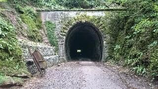
Up early to avoid any disgruntled farmers or cows come to that! and i'm back on the paved cycle track that the south west coastal path follows, lovely easy going although i'm a little foot sore here!. around Penhill point with a misty view over the river to Chivenor the royal Marines base! then crossing a bridge at Fremington i pass an old fortification  presumably an early sea defence?.
The paved trail takes me through miles of marshy land to my right and farmland to my left until Instow is reached with its Navy buildings, heading south from Instow another naval building with what looked like a fast response boat moored up to its pontoon was in stark contrast to the array of teddy bears tie wrapped to the fence keeping people away from the docks buildings!.
On and under the towering bridge that carries the A39 around Bideford, i come to an area marked accurately on my map as 'East of the water'. crossing to the west and Bideford proper  i'm in time for Lunch so a pleasant cafe supplies me with a good full English breakfast!
West out of town i pass the curiously named 'Ultimate Adventure Centre The Big Sheep!!' they have strange ways this far west!!!!
Passing through Abbotsham and out to Green cliff farm and i'm finally following the coastal cliff path, and my god this is hard going!!!!! constant ups and downs are taking what little energy i have! this is not good. three kilometers of this and i'm feeling shaky.....i make the decision to head away from the coast and up to Horns Cross where i sit for while on a bench at a closed pub.
In my exhausted state i'm still to stuborn to stop so i head west along the A39 to Hoops public house, where my exhaustion gets the better of me, i relent and this smelly wanderer takes an expensive room for the night with the hope a good meal or two will set me up again for the next day.

Bideford and the river Torridge

Day 52 Monday 29th September (posted a lot later!)

Rising with the sun (which was hidden above the hazy morning sky), I head off from the garden campsite of the Exmoor forest Inn at Simonsbath, west along the B3358 a little murky under the autumnal shroud of the tunnel of trees that the road passes through, and fairly hazardous dodging the early morning traffic. after 4 km of this I pick up the macmillan way uphill through misty moorland to Moles Chamber, which remained hidden from my view. nonetheless it was a good relief to escape the roads for a while!.
This inevitably didnt last for long as the direction of travel was straight onto a single lane road over Shoulsbury common and under the (hidden in  clouds) remains of Shoulsbury castle, over a five way crossroad and i hit another roller coaster road through Fullaford and Leworthy up to the top of Bratton down, an appropriately named hill as from here the road descends into Bratton Fleming where a village shop supplied a breakfast roll to stoke this hikers engines!, from the village i chose a descent into the valley of the river Yeo which i was to follow nearly all the way to Bartnstaple! this route was a good choice as the path just over river wended its way up and down the hillside in pleasing woodland until i rejoin the alleged B road to town, an extremely busy road that need required me to be on alert! which proved handy as i was soon chasing a Buzzard along the road as it flitted from perch to perch! great view!.
passing the road to Hakeford i see a magnificent tho sadly abandoned railway bridge towering over my head.
A few more twists in the road and countless cars dodged i enter into Barnstaple having walked 15 miles in a morning! abusing this progress i wander aimlessly through town picking up the usual provisions and the added bonus of a good meal!! as ever in town my sense of direction was awry! but soon enough i found the south west coastal path north of Bickington where a slow pace led me to a nice wild camp overlooking river Taw and tonights rest.    


view of the river Taw from Barnstaple


Sunday, 28 September 2014

Day-51 Pac man mode!

A dry woodland wild camp again with another warm night. waking hungry again I decided to alter today's route from the off the route stays the same keeping to the Coleridge way a long haul uphill through the lane pictured, down a short lane to court farm and I'm walking along idyllic valleys with steep sides that are Beech covered and lush! Makes a change to be walking along valleys in this are rather than up and over! To Kingsbridge and normal service resumes with a long long haul up Lype hill, a nicely rounded hill this one with wide panoramic views in the early autumn sunshine, a nice long easy downhill into Wheddon cross where a small Garage had a good sized store as part of its holding's, a good coffee and adequate bacon roll along with other provisions saw me sat down eating on a nice bank of grass over road from the store. Catching more sunshine in the process. A chap cycling came over for a chat, a fellow wild camper it turned out, who had been on a three day wander and camp trip. Interesting guy who's certainly seen the world!.
At Wheddon is where my route changed, sticking to the B3224 rather than heading for the moors I start eating up (pac man mode) road miles and pub stops first at Exford in time for a good Sunday lunch and then finally to the Exmoor forest Inn for a second Sunday lunch! And free camping in their back garden! Great and recommended pub!

Saturday, 27 September 2014

Day-50 no longer on the level!

As often happens the transition from rest day to walking again can be difficult. Today's start was a bit like reviving the dead! A lateish start and body and mind not wanting to do as required didn't help, it was a bit like jump starting a car uphill but start I eventually did.
Uphill in the smilie was accurate as shortly after leaving the site I'm heading up into the Quantock hills a high range that quickly puts the levels behind you, very quickly in my case as my route is straight up and over. At the top I'm surprised at finding highland cattle, always pleasant beasties!
Down into Crowcombe then under the west Somerset railway where steam and diesel locomotives were shuttling tourists back and forth.
Following the track for a bit then heading into Stogumber (love these names!) In time for dinner at the pub, a very nice streak and kidney pudding.
With the hills rising around me on this balmy but grey day I pass through the village of Monksilver before a rollercoaster of hills through Huish Berton where i find the Austin six in the picture. Then up and down the route brings me to Roadwater where I stock up with provisions before passing the still to open valiant soldier pub and following the Coleridge way into the woods, where as I lay in my tent writing this the owls seem to be harassing pheasants... Noisy sods!!!

Friday, 26 September 2014

Friday 26th September

Rest day at curry pool mill campsite in lovely sunshine, clothes washed and dried blog caught up and lots of chilling out!
The evening sees my mates Rab and Saz from yeovil pay me a visit and treat me to a pub meal! Much appreciated peeps ! And great to see familiar faces, the first in six weeks!

Day-49 On the level

The field pitch of last night went without a visit from a shotgun toting farmer or a visit from cows in the next field! Though either was possible!
An early start saw me leave Allerton moor and continue across the Somerset levels to a village called Mark with its shop open early I could restock food for the day. Meeting some locals who expressed interest in the walk, with wishes of good luck I move on.
A straight track/road through Mark moor and I meet a heard if cattle being driven towards me. Knowing how skittish cattle can be I wait in a gateway until after much hesitation they pass.
Further on I reach gold corner a farm and major pumping station for the levels that boasted a spring tide that would reach half way up the first floor of most modern homes! Wonder where it reached in the flood of last winter? (2014).
The station pumps into the broad Huntspill river that upon close inspection looked higher than the foundations of the pump house...
On to Cossington where I join a short stretch of railway line before crossing the fields to Bridgewater. With the land so flat here you can't tell from the buildings that the town is so big, only the major A roads approaching give you a clue.
Into the centre a pub meal was found before heading out through a street fair where I felt disjointed from all the stalls with their gaudy tat on sale and the crowds pushing to enjoy the rides. I'm definitely a big step sideways from society while I walk this trek!.
With more provisions loaded up for my rest day tomorrow (no room at the inn for Friday and Saturday) I head west to Curry pool mill campsite for a good rest and clean up. This will also save me £50 in accommodation costs so not a bad change of plan ;0)

Day-48 A fruity passage!

My pitch under hawthorn bushes on çadbury camp hill provided a good dry night despite the gentle rain in the early morning. Everything packed away well and the sharp descent to Tickenham proved easy.
At this point I altered the route after last night's failure to find a shop. The route towards Nailsea took me over monkey bridge, interestingly named after a traveling menagerie lost it's monkey carriage here in 1906! Nice piece of local info from the local council who secured a plaque here!
Into town and a very convenient co-op secured my food for the day.
B roads from town through Chelvey and Claverham, with the clouds being blown away south and sunshine becomes dominant as I enter Yatton. A quick hop across some fields and my way becomes easy level but busy as I join the old Strawberry railway line now a cycle track/nature reserve. A quick conversation with another walker reassures me it's not just me who can't hear cyclists until they are right upon you, so taking a slightly militant approach I decide to hog the path! At least now 'the silent menace' as my fellow walker branded cyclists would have to pass politely!
Through Sandford and into Winscombe before rejoining the strawberry line to make use of the easiest passage of the Mendip hills that is available, railway line and tunnel! (pic) .
A bit of road walking through lower Weare and footpaths take me through Badgworth and Stone Allerton until I find a pitch in the fields.

Tuesday, 23 September 2014

Day-47 The sweet spot

As ever a camp beside a river means that you wake up in the mist! And after a clear night it's a now a cold brisk morning. With the sun rising behind me the temperature soon improves and matches the fine views of the wetlands along the river. Wild fowl are in abundance and twitchers are flocking to see (sorry!).
Bad jokes aside ... I walk on into Severn beach and find a bakery open selling breakfast rolls and tea so a quick stop is in order.
Back on the path and following my old route in reverse I find that a cycle way now links up to the industrial estate here, wonder if it existed in 2010? Would have been nicer than the traffic dodging I remember doing! And it really is better wending it's way through the estate with bushes either side and a pleasant steam that looks in a healthy state , you soon forget the sounds of industry around you.
The past joins the Lawrence western lane and over the M5 motorway on a bridge that had been preconstruction back in 2010 requiring an alternative route, today it takes me into the suburbs of Bristol and to a Gregg's where I load up for dinner.
Rejoining the cycle track I head towards the M5 and up onto the bridge over the river Avon , great views back to Bristol and forward to Portishead. My path though wiggles it's was down and under the M5 to join with an abandoned railway before coming back over the motorway to Portbury , where a quick pint of ale in the sunshine set me up for a walk under the Beech trees of prior wood, the path goes uphill here Charlton farm before cutting back into the woods and over to Naish house, a curious building that needs some research doing into its history.
The path i follow then joins an anonymous B road through Lime Breach wood where the occupants of the massive  houses maintain their anonymity with high walls, CCTV cameras and signs warning 'beware ferocious dogs patrol here' just made me more curious to find out who lives here!.

On a bit more along the ridge to the iron age ring fort (pic) of Cadbury Camp where I find my sweet spot for a pitch for the night!

Monday, 22 September 2014

Day-46 The last border crossing

Last night's B&B was a good and needed move , I really needed to eat like I did, once more the calories had been too few for the exertion in the last few days. Now though I'm seeing the problem a lot sooner, should have it sorted by the time I finish! Lol
Away from the castle inn and I disappear into the morning mist following a route through town that I'd looked at over new year, recognise the church Ruth or JP ??
Very atmospheric in the mist.
From Usk the road naturally climbs up a steep hill, gotta love these valleys!!! The road degenerates into a rocky byway which in turn becomes a sunken lane before reaching the hill top. A few turns and the tarmac reappears before I climb a stile and attempt to follow a path to priory farm. Without the GPS I'd have been walking in circles here. Thank goodness for tech! Although it didn't help with finding one path where I eventually scrambled up a steep slope with the aid of trees and roots to haul me up! Through another overgrown byway and I hit B roads , I'm making good time on the roads and I reach Mynydd Bach in time for a lunchtime beer , back on the roads to Chepstow where I restock meths for the stove.
While here I have another radio interview even now it feels surreal to be sitting in some housing estate and talking to Northamptonshire!!

From Bulwark (the estate) I find the footpath that goes the length of the M48's bridge over the river Severn and finally out of Wales into England. on the far bank at Aust I reach the path I followed on my lejog this is the first time I've crossed my 2010 route since John O'groats! Sticking with the old path for a mile until I'm about half way between the two Severn bridges where I find a nice out of the spot for tonight's camp. With views of the sun setting over the river to complete the day.

Day-45 The Skirrid and beyond

Similar to the day from Hay, today started with a long steep uphill, this one though was long over due. The Skirrid (holy mountain) is a hill that I've long wanted to climb it's a small ish but impressive lump from the north, with extremely steep sides and a long ridge descent to the south. Naturally I get the steep climb! But it was so worth it! Due to it's small peak the Skirrid gives a stunning 360 degree view of the black mountains, long town valley, England and on a clear day the Severn estuary, not quite clear enough for that today with the slight autumnal haze, but a beautiful day none the less! . walking down the ridge I get chatting to a fellow hiker who informs that after the war Rudolf Hess was incarcerated in what is now Abergavenny hospital and he was used to exercise by walking up the Skirrid with his guards, not such a bad life!.
Away from the hill across pleasant farm land to a very unused byway which I had to hack my way through, but just about passable. At llanddewi Rhydderch I join the number 42 cycle route for an easy road stretch to Abberffrwd and then on to the Esk valley way for a long gentle walk along the river to Usk passing the now inevitable Himalayan balsam that's taken over our river banks for most Britain that I've seen. Can't say I'm too fond of its sickly sweet smell!.
At Usk I restock provisions and head to the private campsite at Usk castle who had previously arranged access for me, though with no one about and nobody answering the phone I didn't feel comfortable just setting up here, so into town again and a B&B was booked for the night at The Castle Inn.

Saturday, 20 September 2014

Day-44 donkeys in the mist

Radnors end campsite worked out very nicely. And a thank you to them for the free pitch!
The walk downhill into hay gave an easy start to loosen leg muscles then with provisions purchased I started the 6km walk up to the top of Hay bluff, very steep in places but finding the donkeys in the pic gave me an excuse to stop and gave them a good fuss!
With every step up I was walking deeper into the cloud and a light but continuous rain, the path loops around to approach the top from the north east flank of the ridge, although by this time all I knew was that I was going uphill with about 8mtrs visibility. Reaching the top was OK my fitness must be massively improved over my normal condition! And so I started the 15km walk along the top of the black mountains. In good conditions this is a fine walk with great views, not for me today tho. So head down and march, I did meet two other souls up there but we were all eager to complete our walks and passed with brief Hello's.
Down and out of the clouds and the short walk to days end at llanvihangle Crucorney set me in sight of my next hill The Skirrid. The local pub of the same name has the translation  of this meaning Holy mountain! Tomorrow will tell!

Saturday 20th sept rest day 7

Another days rest and reading eating, washing of clothes plus a trip to the pub..... Nothing else ;-)